LOCLYS has released a location analytics platform designed to help businesses make decisions based on how many potential customers are in a specific geographical area.
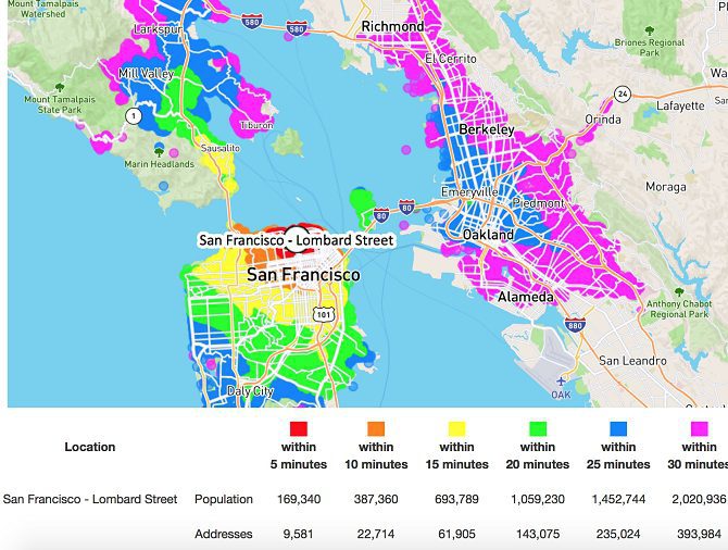
The platform combines high resolution address databases with population data and calculated drive times to create color-coded maps.
With LOCLYS, retailers can get a better understanding of where their consumers are by:
Advertisement
-
Automatically calculating the driving time to every address in the area with a route planning software;
-
Visualizing the potential drive time separating their business location and potential customers;
-
Receiving detailed reports of how many potential customers live in a confined business area, with groupings between five and 30 minutes; and
-
Receiving a personal dynamic map with the result that zooms up to the household level. The LOCLYS team can send an email including the analysis within 120 minutes.
LOCLYS location analyses are also available as printed map posters, which can fit on office walls and serve to visualize your business location.